UK'S LARGEST PORTAL FOR IN-HOUSE DRONE PILOTS
- CALL TODAY ON : 0800 433 7186

Experience Accurate Results with SkyCam's Drone Mapping Service
Are you looking for a reliable drone service for mapping? SkyCam is a leading company in the droning industry who specializes in providing accurate results through their drone mapping services. With their state-of-the-art technology, SkyCam offers an unparalleled level of precision and detail that can be used for a variety of applications, from surveying to engineering and more. Experience accurate results and be assured that your project will be completed in the highest quality with SkyCam's drone mapping service.
What is Drone Mapping and How it Works?
Drone mapping is a process of using drones or unmanned aerial vehicles (UAVs) to create high-resolution, 3D maps and models of large areas and terrains. This technology allows for faster, more efficient, and more accurate data collection than traditional mapping methods.
The drone service for mapping works by attaching high-resolution cameras and sensors to drones. These drones then fly over the area being mapped, capturing images and data that are later used to create detailed maps and models. The data collected by drones can include topographical information, geological features, land use, and vegetation coverage.
Once the drone has finished collecting data, it is transferred to a software program that uses specialized algorithms to process the information and create a 3D model. This model can be viewed from different angles, zoomed in for closer inspection, and can be overlaid with other data such as GPS or satellite imagery. Drone mapping has revolutionized the way many industries conduct surveys and assessments. It has proven to be particularly useful in agriculture, construction, mining, and urban planning. Drone mapping is also used in emergency response situations where quick and accurate data collection is critical. Overall, drone mapping offers a faster and more efficient way to collect data that can be used for a range of purposes. By using drones, it is possible to map areas that are difficult or impossible to access using traditional methods, providing valuable information that can lead to better decision-making and improved outcomes.
The Importance of Accurate Mapping in Various Industries
Accurate mapping plays a critical role in many industries, from agriculture and construction to surveying and environmental management. In the past, these industries relied on traditional mapping methods that were time-consuming, labour-intensive, and often inaccurate. However, with the advent of drone technology, businesses can now access drone services for mapping to achieve faster, more accurate results.
Drone service for mapping is a powerful tool that enables businesses to create high-resolution maps and models of their work sites. By utilizing drones equipped with high-tech cameras and sensors, businesses can gather data more efficiently and accurately than ever before. This data can then be used to optimize work processes, improve productivity, and save money on labour and resources.
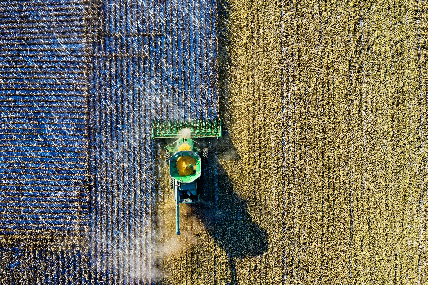
In agriculture, accurate mapping is essential for crop management. Farmers can use drone services for mapping to monitor crop health, identify problem areas, and make informed decisions about fertilization, irrigation, and harvesting. Construction companies can also benefit from drone mapping, as it allows them to create precise site plans, monitor construction progress, and ensure that all work is carried out according to design specifications.